Home › Roof Imagery
Oklahoma City aerial imaging
Roof drone imagery in Oklahoma City
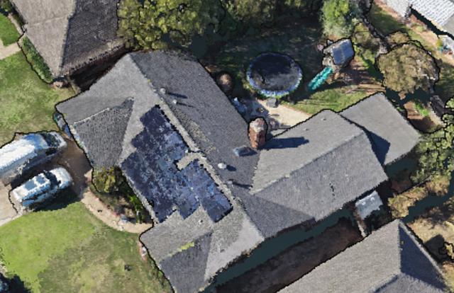
Get clear, close views of roofs and exteriors without anyone climbing a ladder. Useful after hail and wind, before a bid, and for documenting a repair.
What you get
- Full roof overview plus each slope and elevation
- Close-ups of chimneys, flashing, vents, skylights, valleys, and gutters
- Organized, dated photo sets for roofers, public adjusters, property managers, and homeowners
- Before-and-after sets for repair and replacement jobs
- Original files kept on request
How it works
- Text or call with the address and what you need to see.
- We fly the roof and exterior as soon as weather and airspace allow.
- You receive organized photos by slope and area through a shared link.
We provide imagery only. We do not give repair recommendations or determine cause of loss.
Why High Point
- Veteran-owned and based in Oklahoma City
- FAA Part 107 certified pilot, $1M drone liability coverage, certificate of insurance on request
- LAANC airspace authorizations handled where they apply
- Edited files delivered through a simple shared link
Questions
Do you make repair recommendations or determine cause of loss?
No. We document what is visible from the air for you or your contractor to review. We are not roofers or adjusters and do not decide coverage.
Do you use thermal or other special sensors?
No. We provide standard visual (RGB) imagery.
Can you work with my roofing or adjusting company?
Yes. Many jobs come from roofers, adjusters, and property managers who need clean, organized photo sets quickly.
What areas do you cover?
Oklahoma City and the surrounding metro, up to about 60 miles out, plus farther by request.
Where we fly
Based in Oklahoma City and serving the metro and up to 60 miles out, plus statewide and beyond on request: Oklahoma City, Edmond, Norman, Moore, Yukon, Mustang, Midwest City, Del City, Choctaw, Piedmont, Guthrie, El Reno, Shawnee, Chickasha, Purcell, Blanchard, Tuttle, Newcastle, and everywhere in between.